The Edinburgh Natural History Society were recently kind enough to ask me to guide them on a walk around 38 hectares very close to my home, and my heart.
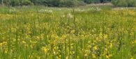
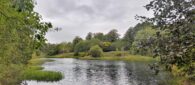
The biodiverse site on the edge of Linlithgow links heath land, woodland, a large pond (known locally as The Lagoon) and the River Avon.
It was once a sand quarry (until 2000) but has seen a large amount of re-wilding thanks to tree planting and I am part of a campaign to save it from housing developers who are being invited to buy it by the former quarriers. Learn more about that at our Facebook page – Green Battle Linlithgow.
So, with the forecast promising a fairly dry day, a dozen of us set off. After explaining the history of the site – which stretches back nearly 500 years as it was where the Battle of Linlithgow Bridge took place – I then made a plea to find a rare moth, beetle or plant that would stop any house building. It was a plea in hope rather than expectation because what I was really hoping to do was learn more about this place I have a deep affection for.
And right away I was learning; who knew how many insects live on plants, every single plant?
To say the walk was long would be wrong; the route I had chosen is one I have done many times and I would allow around an hour, and I think of myself as a relatively slow walker (it is the best way to see things).
By the standard of my companions however, I was an Olympic sprinter. Such was their dedication to study the plants and animals that the walk was to take close to five hours, but a really good five hours.
The Edinburgh Natural History Society says on its website: “Mosses, birds, insects, flowers, trees, sea-life, fungi, mammals and much more – we’ve got them covered.”
And importantly for me it adds: “Field trips are focussed on what is found on the day and there are generally a number of specialists to share their expertise. There is no fear in asking about the very common such as a daisy, you will also gain knowledge less commonly known.”
My big learning was how much life is on a tree. Those little balls, or bits of minute fungi are galls – and they might contain insects, bacteria, fungi or viruses.
Oak trees were a favourite place to see them – apparently, they can be home to wasps, and the oak apple gall is quite big and does look like an apple, making it easy to spot. But because of the other creatures and organisms it means that “normal” tree is home to more things than Edinburgh Zoo.
Slowing down is a great thing to do whether you are looking for a golden eagle or an aphid. Previously I would look in the middle distance to increase my chances of seeing birds or mammals but on this day I was crouching down and peering under leaves.
More than 100 species were recorded in total, from hoverflies to an unusual sedge (Carex spicata) to birds and mammals. But for me it was spending a long, time in one place that really fascinated me, allowing time to really explore everything, big and small.
I was sent a list of all the birds which had been seen and heard which probably really illustrates just how much nature there is in a relatively small place.
Birds seen: mute swan, mallard, moorhen, buzzard, magpie, carrion crow, jay, wood pigeon and robin
Birds heard: dabchick, chaffinch, willow warbler, blackcap, chiffchaff, treecreeper, wren, blackbird, song thrush, skylark and pheasant
As we made our way back to the promise of coffee at the end of the walk, I realised I had been well and truly educated. Obviously, I knew nature provides a rich, diverse and fascinating bounty to enjoy. But to have my eyes opened to this apparently never-ending array of life had been extraordinary, especially as much of it had been there all the time, it just took a group of enthusiasts to point it out to me.
Unfortunately, none of this actually helps stop housing development if a builder were to buy the land and apply for permission. It seems that some species are more important than others and some biodiversity is more important than others.
We will, however, continue our fight to save Linlithgow’s biggest accessible green and blue space for the benefit of the flora and fauna, as well as the walkers, cyclists, wild swimmers, anglers and nature lovers.
It would be nice to think that an area so biodiverse, which is loved and used by a range of people – both locals and those who travel to it from across the Central Belt – would be deserving of protection from those who come up with rules and regulations. That may be viewed by “pen pushers” and some large companies as a rather incongruous view but I believe it is how many people actually look at the world they live in, even the tiniest parts of it.
Enjoy locations like the Hermitage near Birnam this autumn and winter
The coming of the colder months often makes walkers pack their boots and rucksacks away until the longer days return in the spring. But I would argue that is a mistake as now is the time to see a more wild, rugged side of nature.
That does not mean you have to prepare for an outing as if you are in the SAS; there are plenty of lower level routes which can be easily done before the daylight ebbs and, most importantly, are great fun.
So here are five routes to choose from – all appear in my latest book for Luath – Highland Walks
GLENMORE, NR AVIEMORE
A beach above 1,000ft – in winter – and one of the last remaining areas of the ancient Caledonian Pine Forest provide a brilliant stroll with plenty of trees to climb, should you be feeling extra energetic, or have some intrepid children with you.
INSH MARSHES, NR KINGUSSIE
This National Nature Reserve, looked after by the RSPB, is a great for gazing across, spotting birds or admiring the Monadhliath Mountains beyond. At this time of year look out for loads of wintering whooper swans and greylag geese, or hen harriers gathering to roost.
FRANK BRUCE SCULPTURE TRAIL AND THE RIVER FESHIE
Taking in two short, waymarked trails, a magical sculpture trail is followed by a path by a river (be careful, it is fast flowing) and some good picnic spots along the way.
RED SQUIRREL WALK, BLAIR ATHOLL
A great chance to see the cheeky wee animal among delightful, ancient woodland. The River Tilt and an elaborate stone grotto add some grandeur to the route which is great when time is short, or legs are very little.
INCHEWAN BURN AND THE HERMITAGE, BIRNAM
The Inchewan Burn offers a quieter way to reach the Hermitage: a gorge holding a foaming river and some of the tallest trees in Britain. There are also a couple of follies built in honour of the legendary bard Ossian – a hermit’s cave is particularly good for children to explore. A return takes you higher up with views of Highland Perthshire.
A version of this article first appeared in The Scots Magazine in July 2022 and a walk here appears in my latest book for Luath – highlandwalks
For just over 14 miles Loch Ericht lies nestled in a great gouge through the Grampian Mountains, created by a huge glacier retreating at the end of the Ice Age.
Other than Munro-baggers and climbers, however, it is largely unfrequented compared to other more “famous” lochs such as Ness, Lomond or Tay. It is though worth a visit for tranquillity amid some of the grandest scenery in the Highlands.
The first thing that strikes you as you reach its north eastern tip near Dalwhinnie is the great, looming mass of Ben Alder. This isolated mountain was used by Robert Louis Stevenson in Kidnapped when David Balfour and Alan Breck Stewart hid there. In real life it is said Bonnie Prince Charlie also used it as a place of refuge following the Battle of Culloden – as with the characters in the novel he was believed to have been helped by clan chief Cluny MacPherson.
Ben Alder is usually climbed in a two-day expedition involving much exertion. However, an exploration of the loch shore via a well-made track along the north west side can be as short or long as you like and with mountain bikes can be made longer. (But always remember that you have to come back as far as you have ventured.)
A good aim is the five miles to Ben Alder Lodge (so, ten miles there and back). But much closer – in fact it is only about an hour there and back on foot – is The Shieling, a kind of gatehouse to the Ben Alder Estate and a perfect destination for a family wander. Just above it is a picnic table at a great viewpoint which makes a brilliant stopping point for lunch. And the forest behind is ideal for a game of hide and seek, just don’t go too far uphill and get so hidden you become lost!
Note that the level crossing near Dalwhinnie Railway Station – typically used to access the loch – has been closed by Network Rail until further notice. A diversion is in place beginning from a track which starts along the road, next to the village’s petrol station. This leads down to the loch and bears right to reach the shore.
Beinn Dorain was the aim, from below it seemed to have retained a little of its winter coat of snow but it was worth going up, especially on a glorious spring day. This huge, pointed summit above Bridge of Orchy greets drivers as they crest the hill above Tyndrum on the A82, acting like a magnet to walkers who want to reach the top of this most mountainous of mountain summits.
The walk up, however, is deceptive. It is fairly steep on the way up Coire and Dothaidh, and along the broad ridge, but not nearly as steep as the southern slopes seen on the drive to the start.
On this particular day I turned back before the summit, unsure if the ice axe and crampons I had left at home would be needed. Remember, even in late spring, the higher mountains can hold on to winter. It was still a great walk, however, and from that height the views were superb.
Below the mountain is the little straggle of houses which makes up Bridge of Orchy, as well as a very walker-friendly hotel. If there was ever a walk where you come down, have a drink and think “I want to live here” this is one. Before you leave, make sure you go behind the hotel to the stone bridge and look back at the view up to a fine mountain.
Munro baggers would include Beinn an Dothaidh in this walk and it is quite an easy addition, lying the other side of the bealach at the stop of Coire an Dothaidh. Others are content to leave that for another day and spend more time enjoying the summit views from Beinn Dorain, encompassing a myriad Munros in all directions.
DISTANCE: 6¾ miles/ 11km
HEIGHT CLIMBED: 3,110ft / 950m
TIME: 5 to 6 hours.
MAP: OS Landranger 50.
PARK: Heading north along the A82, about 6 miles north of Tyndrum turn left just before the Bridge of Orchy Hotel into a large car park.
THE ROUTE: Cross the A82 in front of the hotel and go up a minor road to the railway station. Take the underpass below the rail line, go through a gate and cross a track, taking a path to the left. This goes to the left of a radio mast and then bears right, up to the steep-sided Coire an Dothaidh. Eventually you reach the bealach and its cairn. Go right and walk up a steep path to a small lochan which you pass on the left. The path then goes up another steep section. At the top of this skirt round the right side of a rocky outcrop and then bear left to reach the top of the main, broad ridge. Follow the ridge up to a large cairn before dropping down slightly before rising up to the actual summit and its cairn. Return to the bealach and drop back down Coire an Dothaidh to the start – unless adding Beinn an Dothaidh on the other side of the bealach.
The new year is upon us – a whole 12 months to get out and enjoy some brilliant walks around Scotland. Whether that means a return to some old favourites, a new challenge or simply a wee stroll with friends, the choice is endless.
So, here are five walks to get you going – if you’ve been taking it easy the last few weeks it may be best to work up to the last one.
BINNY CRAIG, WEST LOTHIAN
DISTANCE: 3½ miles.
HEIGHT CLIMBED: 435ft / 135m.
TIME: 1½ to 2 hours.
MAP: OS Landranger 65.
PARK: You can park by the roadside in Ecclesmachan – off the B8046 between Threemiletown and Uphall – but be considerate of residents.
THE ROUTE: Binny Craig is a great start to the New Year. This craggy outcrop – containing the only real rockface in West Lothian – can be seen for miles around and offers great views. The panorama takes in virtually all of the Firth of Forth with the Ochil Hills and Trossachs beyond.
A walk takes you up from the hamlet of Ecclesmachan and past Oatridge College and its farmland before ascending the steep slopes of the very top of the hill.
AN LOCHAN UAINE AND RYVOAN BOTHY, CAIRNGORMS
DISTANCE: 5½ miles / 8.85km. HEIGHT CLIMBED: 500ft / 150m. TIME: 2½ to 3 hours. MAP: OS Landranger 36 PARK: Take the B970 from Aviemore, then go through the Rothiemurchus forest to Loch Morlich and park at its eastern end in the Glenmore visitor centre car park. Or, take the 31 bus from outside Aviemore Railway Station.
THE ROUTE: The Ryvoan Bothy, nestled below Meall a’Bhuachaille, is a famous refuge for walkers and a good aim for a winter’s day. The walk up takes you past An Lochan Uaine – known as the Green Lochan and said to be so coloured because fairies wash their clothes in it. A good return goes via a narrow path which climbs steeply and offers a fantastic view of the Cairn Gorm and the Northern Corries, making it a top class short walk.
CASTLE DOW, GRANDTULLY
DISTANCE: 4½ miles / 7.25km. HEIGHT CLIMBED: 730ft / 225m. TIME: 2 to 2½ hours. MAP: OS Landranger 52 PARK: Just north of Balnaguard on the B898 turn on to a track at a Forestry Commission sign for Grandtully. There is a small parking area a few hundred yards up the track.
THE ROUTE: Castle Dow was the site of a Pictish fort 1,000 years ago and is a great vantage point over Strath Tay. From its top you can look west, up to the great bulk of Ben Lawers and the pointed summit of Schiehallion, while to the north is Ben Vrackie, above Pitlochry, with the Beinn a’Ghlo range behind, next to the Munros of the Forest of Atholl, The way up, along a track, is easy with wildlife including roe deer, black grouse and the Scottish crossbill, even pine martens.
GLADHOUSE RESERVOIR, MIDLOTHIAN
DISTANCE: 5 miles / 8km. HEIGHT CLIMBED: 100ft / 30m. TIME: 2 to 2½ hours. MAP: OS Landranger 66 PARK: Just less than three miles south of Temple, turn off the B6372 on a sharp bend. About a mile further on, go left to follow a minor road around Gladhouse Reservoir. After passing below the dam and reaching a t-junction go right. There is parking on the left, just after the road has skirted the eastern edge of the reservoir.
THE ROUTE: Nestled below the Moorfoot Hills, Gladhouse Reservoir is a picturesque, gentle place for a good stroll. You can walk all the way round very easily, crossing a mixture of farmland and quiet lanes. The wide open spaces are all around are the perfect way to unwind.
HART FELL, ANNANDALE
DISTANCE: 9½ miles / 15.25km. HEIGHT CLIMBED: 2,825ft / 860m. TIME: 6 to 7 hours. MAP: OS Landranger 78 PARK: Follow the A701 north out of Moffat. At a roundabout next to Moffat Academy turn right, down Beechgrove, and drive for about 3 miles, out of the town down a single track road. Park on the right, just before a sign to Hartfell Spa.
THE ROUTE: Hart Fell, at 2,651ft, offers brilliant views including the Cheviots away to the east, the Lake District to the south and the mountains of Galloway to the southwest. Closer to hand are White Coomb, just north of east, the Lowther Hills to the west and Criffel, just west of south. A circuit finishes with the Devil’s Beef Tub – a huge corrie which was once the holding place of stolen cattle. This is a strenuous walk but one that will live long in the memory.
Lillias Adie was an elderly peasant woman, possibly with learning difficulties, who was accused of witchcraft in 1704. She died, probably after being tortured, in prison. To stop her being reanimated by the devil and returning to the village, she was buried between the high and low tide marks at the bay in Torryburn, a village in Fife.
The site of her grave was rediscovered just a few years ago. A plaque in her memory now sits in the shore opposite her grave. Two more plaques were put in place to commemorate those killed as witches during the period 1563 – 1736 and these make up the West Fife Witches’ Trail, below.
You can miss out the second plaque and instead walk around the ash lagoons and the now landlocked Preston Island, which also avoids some of the road section. This does make the route longer.
The Details
HEIGHT CLIMBED: Negligible
TIME: 1.5 hours
MAP: OS Landranger 65
PARK: Car park on the right at the end of Torryburn village. Also car parks in Culross if you wish to do the walk the other way
The Route
Turn right (west) from the car park at the west end of Torryburn to follow the shore. On reaching a pavement, continue in the same direction and look for a plaque on the left, just before you pass below a railway bridge.
At a marker post for the Fife Pilgrim Way, bear left to follow a path between houses to reach a small playground and then continue along the coast (which is the other side of a railway line).
At a playing field, bear left to continue along the shore. After passing Delta Cottage, take a path on the left, with another marker post at its start.
After passing a short way though woodland, go right at a litter bin to reach a main road, where you go left.
Once you have crossed a bridge over Bluther Burn, cross the road (carefully) to find a second plaque – below an information board at the entrance to Valleyfield Wood. Re-cross the road, go right and keep left at a junction, following the route of the Fife Coastal Path.
At a sign marking the start of Low Valleyfield, leave the road on a path to the left which swings right then follows the train line again.
At a junction just before a car park, go up steps to the left, turning left at the top.
Cross the railway and follow the path down to a junction, where you go left.
At a junction, stay on the main track by the railway to walk through woodland to the shore.
Go right at a junction to go over a pedestrian level crossing, following a surfaced path going left on the other side. This leads to the centre of Culross – on the other side of a small football pitch is an information board next to a bus stop, below which is a third plaque.
Extras
CHILDREN: Three playgrounds passed on the way. The first is by the car park in Torryburn, the second on the route in Torryburn, the third at Culross. Some sections walking along a main road. Pedestrian level crossing.
DOGS: Some sections alongside a main road. Off-lead potential through the woods. Multi-use litter bins along the way. Pedestrian level crossing.
I am a journalist whose love of the outdoors and all things rural has seen me walking the highest Munros, eating Scottish seafood in Singapore, stalking deer with a camera and just about everything imaginable in between... Find out more...